News
 The Cold Drop! What is a DANA and how does it form?
- 03/11/2024 » 13:57 by cronywell
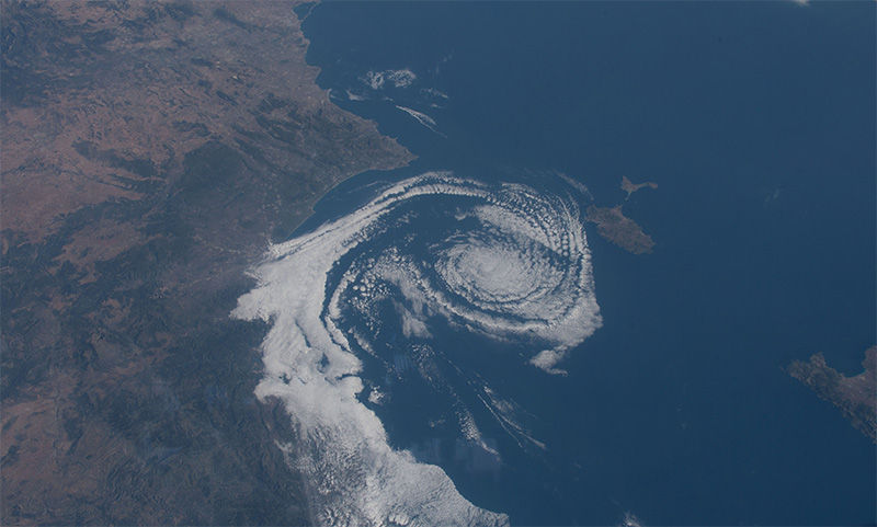
To understand what makes a DANA so destructive, it is first necessary to understand what this phenomenon consists of. Depressions, in meteorology, are areas of low atmospheric pressure, which means that the air is denser in the surroundings than in the center of this "bubble." This imbalance of pressures is essential to generate rain, storms and strong winds.
 In the case of a DANA, the situation is even more complex. This phenomenon, which is also known as a "cold drop," occurs when a mass of very cold polar air is isolated at high altitude, between 5,000 and 9,000 meters above sea level. Unlike other storms, the DANA forms in isolation from the air currents that normally regulate the climate in the northern hemisphere, such as the polar jet stream or the subtropical jet stream. This isolation allows the cold air mass to begin to interact with the warm, humid air in its surroundings, generating conditions of atmospheric instability. The orography of the Iberian Peninsula, particularly the arrangement of the mountains in the Valencia region, favors the rise of warm, humid air from the sea into the atmosphere, where it meets the cold air of the DANA. This clash between air masses in different states of temperature and humidity intensifies rainfall and generates extremely unstable conditions.
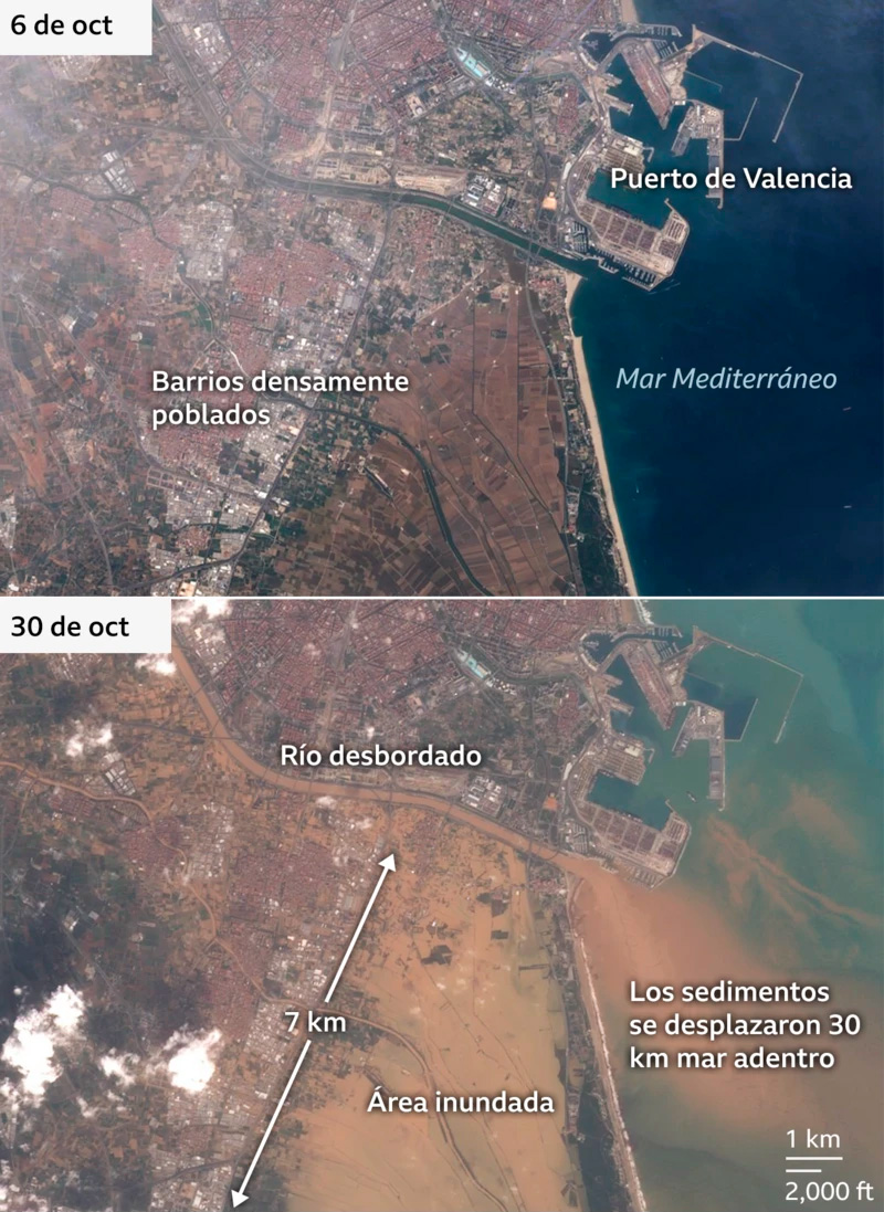
 During the days of greatest activity, some areas of Valencia recorded more than 500 (mm) of water, the equivalent of a year's worth of rain in a matter of hours. This led to massive flooding that swept away entire towns and left thousands of people trapped in their homes and vehicles. The combination of heavy rain, water-saturated land, and an urban drainage system unable to handle this extreme volume of rainfall contributed to the water accumulating rapidly. It should be added that the rains were not only accompanied by thunderstorms, but also by strong winds and, in some cases, tornadoes that hit the region. The magnitude of this phenomenon led the Emergency Coordination Centre (CCE) to raise the alert level to red in several areas of Valencia, issuing warnings to the population to avoid non-essential travel. The frequency and intensity of DANAs have been increasing in recent years. A recent study by the American Meteorological Society confirms that since the 1960s, the number of episodes of this type has grown significantly in the Mediterranean, and many experts point to climate change as a fundamental factor.
 Global warming raises the temperature of the Mediterranean, allowing DANAs to be more intense. The World Weather Attribution organisation, which is dedicated to analysing the effects of climate change on extreme phenomena, estimates that torrential rains of this type are now 12% more intense and twice as likely compared to the pre-industrial climate. Friederike Otto, a researcher at Imperial College London, explains that “we are seeing events from the past, but they are becoming more common and extreme due to global warming.” This phenomenon in Valencia is an example of how climate change is already affecting communities and ecosystems, and emphasizes the need to take measures to prepare for an increasingly unpredictable climate.
