SOCIETY · WEATHER IN ARGENTINA
Strong storms hit the country: yellow and orange alert in more than ten provinces
The National Meteorological Service extended warnings for severe storms, hail, gusts and snowfall to much of the territory, while the storm is already causing flooded streets and delays in the AMBA.
🖊️ Editorial team · 📅 August 1, 2026 · 🕒 4 min read
|
⛈️ 🌧️ 🧊 💨 ❄️
Storms, hail and gusts affect the center and north of the country, with snow in Patagonia
|
A bad weather front is keeping much of Argentina on tenterhooks this Saturday. The National Meteorological Service (SMN) maintains orange and yellow level warnings that reach more than a dozen provinces, with locally severe storms, hail, intense gusts and snowfall in the south of the country.
🌩️ A Saturday under alert in much of the country
The most critical conditions are concentrated in the northeast of the province of Buenos Aires, the south and southeast of Santa Fe, Entre Ríos and Corrientes. There, the SMN predicts locally severe storms, with abundant falling water in short periods, intense electrical activity and gusts capable of causing material damage and complicating circulation.
In the areas under orange warning, accumulated temperatures of between 60 and 90 millimeters are expected throughout the alert period, a volume that in some points could be exceeded. In the sectors with yellow alert, on the other hand, the forecast is around 30 to 50 millimeters, also with the possibility of hail and frequent electrical discharges.
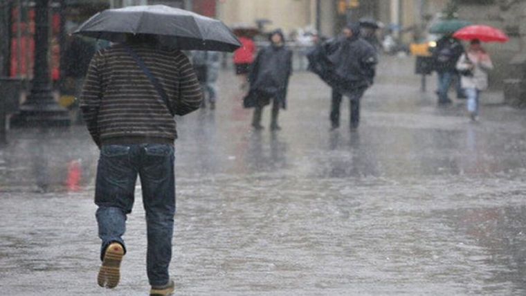
In the AMBA, the rains have already generated flooded streets and delays in transportation during the early hours of Saturday. The agency estimates that the instability will last for a good part of the weekend, so new episodes of intense rain are not ruled out.
📍 Which provinces are under alert
|
LEVEL
|
PROVINCES / ZONES
|
PHENOMENA
|
|
🟧 ORANGE
|
CABA and AMBA, central-east of Buenos Aires, south of Entre Ríos, southeast of Santa Fe, Corrientes and northeast/west of Córdoba
|
Locally severe storms, hail, gusts +100 km/h, 60–90 mm
|
|
🟨 YELLOW (storms)
|
Rest of Buenos Aires, Chaco, Santiago del Estero, La Pampa and north of Corrientes
|
Storms of varying intensity, 30–50 mm, occasional hail
|
|
🟨 YELLOW (wind)
|
Jujuy, Salta, Tucumán, Catamarca, La Rioja, San Juan, Mendoza, north of San Luis, Neuquén and Río Negro
|
West wind 40–80 km/h, gusts +100 km/h, Zonda in Jujuy
|
|
❄️ SNOW / COLD
|
Chubut and Santa Cruz (snowfall); west of Santa Cruz on red alert for extreme cold; Tierra del Fuego in yellow
|
Accumulated from 10 to 40 cm, white wind, very low thermal sensation
|
❄️ Snow and extreme cold in Patagonia
While the center and northeast of the country face storms, Chubut and Santa Cruz register alerts for persistent snowfall, with expected accumulations of between 20 and 40 centimeters in mountain areas and 10 to 30 centimeters in lower sectors, in addition to the risk of white wind. The west of Santa Cruz, for its part, was under red alert for extreme cold, the highest level on the scale, while Tierra del Fuego remains on yellow alert.
|
⚠️ According to the SMN scale, the orange level warns of phenomena with the capacity to harm the population, property and the environment; yellow signals events that can disrupt daily activities.
|
⚠️ Official recommendations in the face of the storm
🏠 Stay in closed buildings and avoid displacements that are not essential.
🚗 Do not drive on flooded streets or try to cross flood zones, on foot or by vehicle.
🔌 Cut off the electricity supply if water enters the house and avoid contact with connected appliances.
🪟 Stay away from doors, windows, canopies, trees, and structures that may be blown off by the wind.
🎒 Have an emergency kit on hand: drinking water, non-perishable food, flashlight, battery-powered radio, first aid kit, and a charged cell phone.
🔮 How the storm continues
The SMN anticipates a progressive improvement as the cold front finishes crossing the region: the rains will lose intensity during Saturday morning and the rest of the day will have a low probability of new rainfall, although with mostly cloudy skies. For Sunday, a more stable day is expected, without rain, but with a marked thermal drop: minimums close to 10 degrees and maximums of around 15 degrees in the AMBA.
🔗 Sources consulted
🔗 MDZ Online — Orange alert for storms in the AMBA and 18 provinces
🔗 Cadena 3 — Orange and yellow alert for storms in six provinces
🔗 La Nación — Red, orange and yellow alert for cold, storms and Zonda
🔗 Financial Sphere — Orange alert for severe storms, hail and gusts
🔗 Profile — The SMN keeps the AMBA and several provinces on orange alert
📷 Reference image (credit: MDZ Online — external link, not incorporated by copyright)
📈 SEO Sheet for Web Publishing
Optimization recommendations to position this note in search engines and generative AI (AEO/GEO), following current technical and content SEO practices.
|
Title tag (≤60 car.)
|
Orange and yellow alert: storms in more than 10 provinces
|
|
Meta description (≤155 car.)
|
The SMN extended orange and yellow alerts for storms, hail and gusts in more than ten Argentine provinces. Affected areas and recommendations.
|
|
Slug / URL
|
/society/storm-alert-provinces-argentina-August-2026
|
|
Keyword principal
|
Argentina Storm Alert
|
|
Keywords secundarias (LSI)
|
SMN orange alert, provinces yellow alert, AMBA storms today, Buenos Aires hail, Patagonia snow, SMN forecast
|
|
Voice/long-tail searches
|
"which provinces are on alert today", "why is there an orange alert in Buenos Aires"
|
|
Header Structure
|
unique H1 with main keyword; H2 per thematic block with long-tail variants for featured snippets
|
|
Structured Data
|
Schema.org NewsArticle (headline, datePublished, dateModified, author, publisher, image)
|
|
Freshness signal
|
Update dateModified and show last updated time while the alert is current
|
|
Image / multimedia
|
Descriptive alt text with natural keyword, WebP formatting, lazy-load, and fixed width/height to avoid CLS
|
|
Internal Linking
|
Link to previous weather coverage and the Weather section of the site
|
|
External Linking (E-E-A-T)
|
Cite the SMN (smn.gob.ar) as a primary source to reinforce authority and reliability
|
|
Legibilidad / skimmability
|
Paragraphs of 2–3 lines, subheadings every 150–200 words, lists and tables for reading in mobile
|
|
Redes sociales (Open Graph)
|
og:title, og:description and og:image for preview on WhatsApp/X/Facebook
|
Read more...
SOCIETY · WEATHER IN ARGENTINA
Strong storms hit the country: yellow and orange alert in more than ten provinces
The National Meteorological Service extended warnings for severe storms, hail, gusts and snowfall to much of the territory, while the storm is already causing flooded streets and delays in the AMBA.
🖊️ Editorial team · 📅 August 1, 2026 · 🕒 4 min read
|
⛈️ 🌧️ 🧊 💨 ❄️
Storms, hail and gusts affect the center and north of the country, with snow in Patagonia
|
A bad weather front is keeping much of Argentina on tenterhooks this Saturday. The National Meteorological Service (SMN) maintains orange and yellow level warnings that reach more than a dozen provinces, with locally severe storms, hail, intense gusts and snowfall in the south of the country.
🌩️ A Saturday under alert in much of the country
The most critical conditions are concentrated in the northeast of the province of Buenos Aires, the south and southeast of Santa Fe, Entre Ríos and Corrientes. There, the SMN predicts locally severe storms, with abundant falling water in short periods, intense electrical activity and gusts capable of causing material damage and complicating circulation.
In the areas under orange warning, accumulated temperatures of between 60 and 90 millimeters are expected throughout the alert period, a volume that in some points could be exceeded. In the sectors with yellow alert, on the other hand, the forecast is around 30 to 50 millimeters, also with the possibility of hail and frequent electrical discharges.
In the AMBA, the rains have already generated flooded streets and delays in transportation during the early hours of Saturday. The agency estimates that the instability will last for a good part of the weekend, so new episodes of intense rain are not ruled out.
📍 Which provinces are under alert
|
LEVEL
|
PROVINCES / ZONES
|
PHENOMENA
|
|
🟧 ORANGE
|
CABA and AMBA, central-east of Buenos Aires, south of Entre Ríos, southeast of Santa Fe, Corrientes and northeast/west of Córdoba
|
Locally severe storms, hail, gusts +100 km/h, 60–90 mm
|
|
🟨 YELLOW (storms)
|
Rest of Buenos Aires, Chaco, Santiago del Estero, La Pampa and north of Corrientes
|
Storms of varying intensity, 30–50 mm, occasional hail
|
|
🟨 YELLOW (wind)
|
Jujuy, Salta, Tucumán, Catamarca, La Rioja, San Juan, Mendoza, north of San Luis, Neuquén and Río Negro
|
West wind 40–80 km/h, gusts +100 km/h, Zonda in Jujuy
|
|
❄️ SNOW / COLD
|
Chubut and Santa Cruz (snowfall); west of Santa Cruz on red alert for extreme cold; Tierra del Fuego in yellow
|
Accumulated from 10 to 40 cm, white wind, very low thermal sensation
|
❄️ Snow and extreme cold in Patagonia
While the center and northeast of the country face storms, Chubut and Santa Cruz register alerts for persistent snowfall, with expected accumulations of between 20 and 40 centimeters in mountain areas and 10 to 30 centimeters in lower sectors, in addition to the risk of white wind. The west of Santa Cruz, for its part, was under red alert for extreme cold, the highest level on the scale, while Tierra del Fuego remains on yellow alert.
|
⚠️ According to the SMN scale, the orange level warns of phenomena with the capacity to harm the population, property and the environment; yellow signals events that can disrupt daily activities.
|
⚠️ Official recommendations in the face of the storm
🏠 Stay in closed buildings and avoid displacements that are not essential.
🚗 Do not drive on flooded streets or try to cross flood zones, on foot or by vehicle.
🔌 Cut off the electricity supply if water enters the house and avoid contact with connected appliances.
🪟 Stay away from doors, windows, canopies, trees, and structures that may be blown off by the wind.
🎒 Have an emergency kit on hand: drinking water, non-perishable food, flashlight, battery-powered radio, first aid kit, and a charged cell phone.
🔮 How the storm continues
The SMN anticipates a progressive improvement as the cold front finishes crossing the region: the rains will lose intensity during Saturday morning and the rest of the day will have a low probability of new rainfall, although with mostly cloudy skies. For Sunday, a more stable day is expected, without rain, but with a marked thermal drop: minimums close to 10 degrees and maximums of around 15 degrees in the AMBA.
🔗 Sources consulted
🔗 MDZ Online — Orange alert for storms in the AMBA and 18 provinces
🔗 Cadena 3 — Orange and yellow alert for storms in six provinces
🔗 La Nación — Red, orange and yellow alert for cold, storms and Zonda
🔗 Financial Sphere — Orange alert for severe storms, hail and gusts
🔗 Profile — The SMN keeps the AMBA and several provinces on orange alert
📷 Reference image (credit: MDZ Online — external link, not incorporated by copyright)
📈 SEO Sheet for Web Publishing
Optimization recommendations to position this note in search engines and generative AI (AEO/GEO), following current technical and content SEO practices.
|
Title tag (≤60 car.)
|
Orange and yellow alert: storms in more than 10 provinces
|
|
Meta description (≤155 car.)
|
The SMN extended orange and yellow alerts for storms, hail and gusts in more than ten Argentine provinces. Affected areas and recommendations.
|
|
Slug / URL
|
/society/storm-alert-provinces-argentina-August-2026
|
|
Keyword principal
|
Argentina Storm Alert
|
|
Keywords secundarias (LSI)
|
SMN orange alert, provinces yellow alert, AMBA storms today, Buenos Aires hail, Patagonia snow, SMN forecast
|
|
Voice/long-tail searches
|
"which provinces are on alert today", "why is there an orange alert in Buenos Aires"
|
|
Header Structure
|
unique H1 with main keyword; H2 per thematic block with long-tail variants for featured snippets
|
|
Structured Data
|
Schema.org NewsArticle (headline, datePublished, dateModified, author, publisher, image)
|
|
Freshness signal
|
Update dateModified and show last updated time while the alert is current
|
|
Image / multimedia
|
Descriptive alt text with natural keyword, WebP formatting, lazy-load, and fixed width/height to avoid CLS
|
|
Internal Linking
|
Link to previous weather coverage and the Weather section of the site
|
|
External Linking (E-E-A-T)
|
Cite the SMN (smn.gob.ar) as a primary source to reinforce authority and reliability
|
|
Legibilidad / skimmability
|
Paragraphs of 2–3 lines, subheadings every 150–200 words, lists and tables for reading in mobile
|
|
Redes sociales (Open Graph)
|
og:title, og:description and og:image for preview on WhatsApp/X/Facebook
|
Close








 Strong storms hit the country: yellow and orange alert in more than ten provinces
- 01/08/2026 » 20:03 by cronywell
Strong storms hit the country: yellow and orange alert in more than ten provinces
- 01/08/2026 » 20:03 by cronywell